
Gisborne Civil Defence is keeping a close eye on rising river levels at Te Karaka, west of Gisborne late this morning, near where a section of State Highway 2 has been closed by flooding.
The Waipaoa River has been rising at 0.8 metre an hour and is predicted to reach 8m at 11pm. The highway has been closed at the Graham Road turnoff to Te Karaka where over half a metre of floodwaters cover the road.
Surface flooding has been reported throughout surrounding areas with trees down in many places.
Just this morning, a car was overcome by floodwaters at Rototahi, south of Tolaga Bay. A bus with no children on board was also stuck at the top of the Waimata Valley.
The Hikuwai River north of Tolaga Bay was close to 8 meters at 8am and rising at one meter an hour. The river is forecast to peak at about 9 meters by midday.
Louise Bennett, Gisborne Civil Emergency Manager, says the area north of Tolaga Bay had had more rain than first expected.
Since 9am on Sunday, the region has been subject to significant rainfall, with the highest being 146mm at Pakarae.
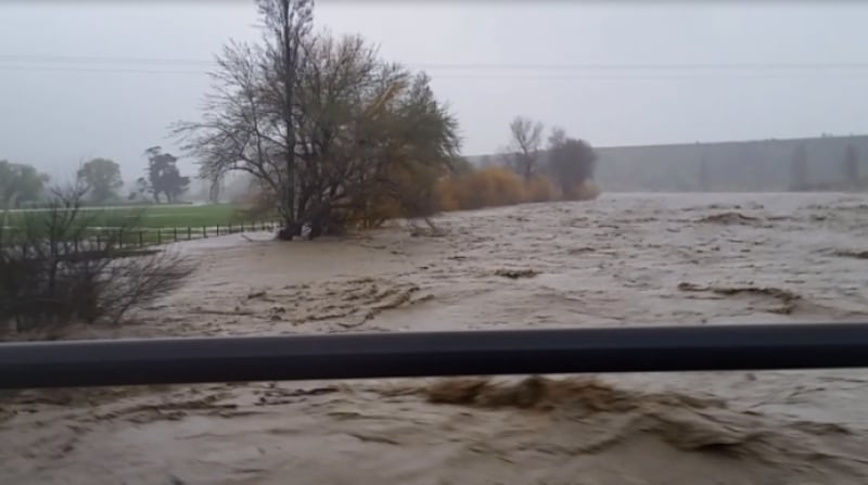
This morning, Te Kāea also received footage from local, Marcus Matawhero Lloyd, showing the extensive flooding of the Waipaoa river which caused the banks at the Te Hau Station in Whatatutu to burst.
A total of 140mm of rain has fallen in Whatatutu since yesterday.
Residents and farmers in the affected areas have been advised of rising river levels.
Both Tolaga Bay and Te Karaka area schools were closed this morning.
If you live in the Gisborne district and are wanting to keep up to date with road closures and river and rainfall data, you can check out the gdc.govt.nz