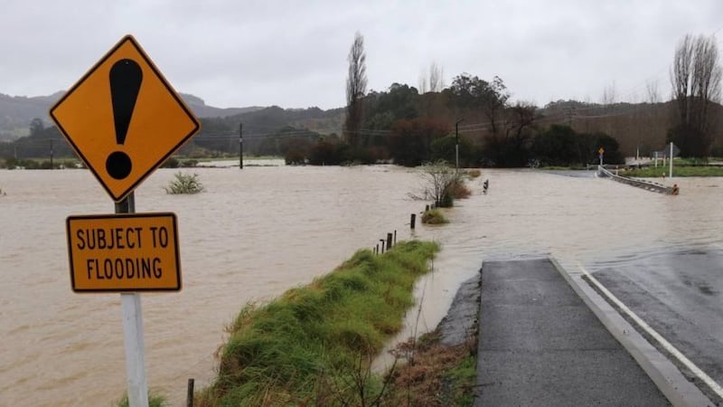
Cyclone Gabrielle brought heavy rain and flooding to Te Tai Tokerau. Photo / Peter de Graaf / NZME
MetService says the quantity of rain that has lashed the upper North Island over summer is historic.
Over the past month, there have been three red-level event warnings issued, with Cyclone Gabrielle the latest.
However, Thursday's thunderstorm warnings for many of the flood-inundated areas were lifted about 7pm last night and for the first time in some time there are no weather warnings in place anywhere in the country.
Whangārei in Northland has recorded its wettest summer ever - with more than a metre of rain recorded at the MetService station at the airport, while its now second wettest summer recorded just 600mm of rain.
Meteorologist Lewis Ferris said many areas of the North Island areas had experienced their wettest-ever start to the year.
"This year so far, we've got stations in Northland, Auckland, Coromandel, Bay of Plenty, Tairāwhiti , Hawke's Bay and Waikato that have had their record 46 days of the year.
"Forty-six days is a bit random but it just goes to show how wet it has been for the beginning of this year."
That much rain was very unusual and would probably be considered a hallmark La Nina summer, although that did not explain the entirety of the rainfall distribution, Ferris said.
"But the whole wet in the north, dry in the south is what we kind of talk about when we're talking about La Nina, so this has been a summer, an event, a beginning of the year that will go down in history books."
The areas devastated by the cyclone were set for a period of settled weather through until the middle of next week, he said.
"We are seeing the last of the rain, the sting in the tail is going, Gabrielle has moved far away and we are looking to have a run of settled weather which will just really aid in that clean-up."
There was no real risk of widespread rain in the North Island until the middle of next week, he said.
"But the good news with that rain is it's moving up from the southwest, it looks like it will be brief at this point, so, even though there is some rain coming, it's not the worst of the rain we could see."
It was still tropical cyclone season so there was still the potential for more to form, he said.
MetService forecasters would be monitoring the likelihood of further tropical cyclones forming, Ferris said.
Roads start to reopen
State Highway 5 between Napier and Taupō is covered in debris and remains closed as does SH35.
Some roads that have reopened in Hawke's Bay and Tairāwhiti are being limited to use by rescue services and trucks bringing in essential supplies.
Waka Kotahi national emergency response team spokesperson Mark Owen said the expressway between Napier and Hastings was not fully open but it was possible to travel via Pakowhai Road.
"It uses part of the expressway but you turn off at the junction of State Highway 52 and Pakowhai Road."
People should not travel unless they really needed to, he said.
"There's a lot of emergency services and equipment that needs to travel between those two towns, so we just ask people if you can avoid travel please do, but if you do need to travel the road is open and secure."
Emergency services can also use SH51 through Clive to get from Napier to Hastings, but it is only one lane and has restricted access, he said.
Access into Gisborne and Wairoa was still extremely challenging, he said.
The first priority once the road opened would be to get emergency and supplies in, he said.
Supplies were currently getting into Gisborne via Ōpōtiki but the road was not open to the public, he said.
"We've made good progress around State Highway 35 so that's now open around the coast through down to Te Puia Springs.
"But the section between Te Puia and Tolaga Bay has been severely affected. We've lost the bridge in there so that has been severed - so the next focus is how we restore access along there."
-RNZ

